Drillholes and strata
Mineral exploration in mining and other similar data collection geo-environmental activities require us to probe the subsurface of the earth. One common method is to drill holes into the earth and recover drill-cores or drill-augur cuttings that are at specified depth-intervals and diameter suitable for the task. Once collected, the drillhole data needs to be processed and converted into forms that can be interpreted and understood through validation and modeling. Carlson has a comprehensive module for exploring drillhole data from different perspectives and levels of detail.
One task important to understanding and analyzing drillhole data is correlating strata across multiple drillholes. This is a start to building a 3-dimensional geological model of the target strata or other subsurface phenomena to see its spatial distribution in a target area.
The geology module in Carlson uses drillholes and other data collection methods such as channel samples, and user-defined 3D polyline data to create geologic models. A few industry-standard modeling algorithms are available to create stratigraphic grid models and block models.
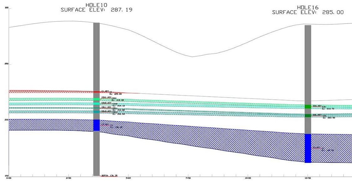
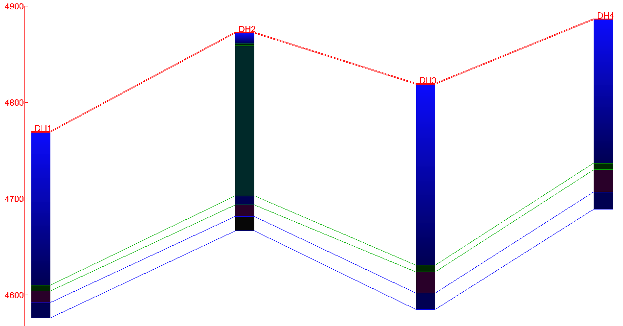
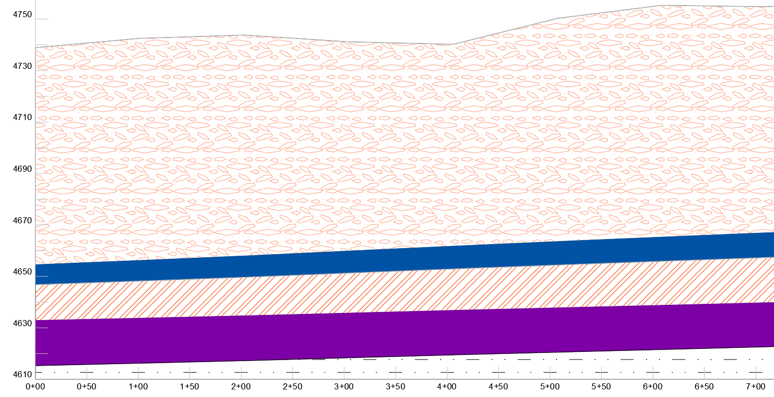
We can create quick views of correlations, depths, and collar elevations of drillholes in a section or fence view. In the example below, we have drillholes with a section line cut through four of the drillholes to show the full depth of each drillhole and the thickness of the different strata intercepted throughout the depth of the drillhole.
The four drillholes are only one view and orientation of the subsurface in the study area. Many such sections can be extracted in different directions and for varying numbers of drillholes to get a deeper understanding of how strata sit. Drillhole labels and depth/elevation scale are available for easy reference.
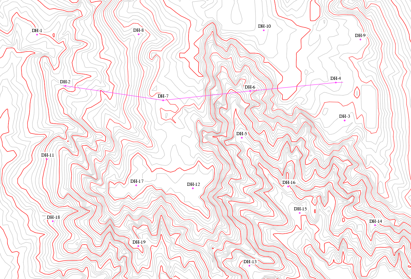
The bedding of the strata in relation to each other and to topography can be shown with another view of a cross-section of the strata itself as in the image below.
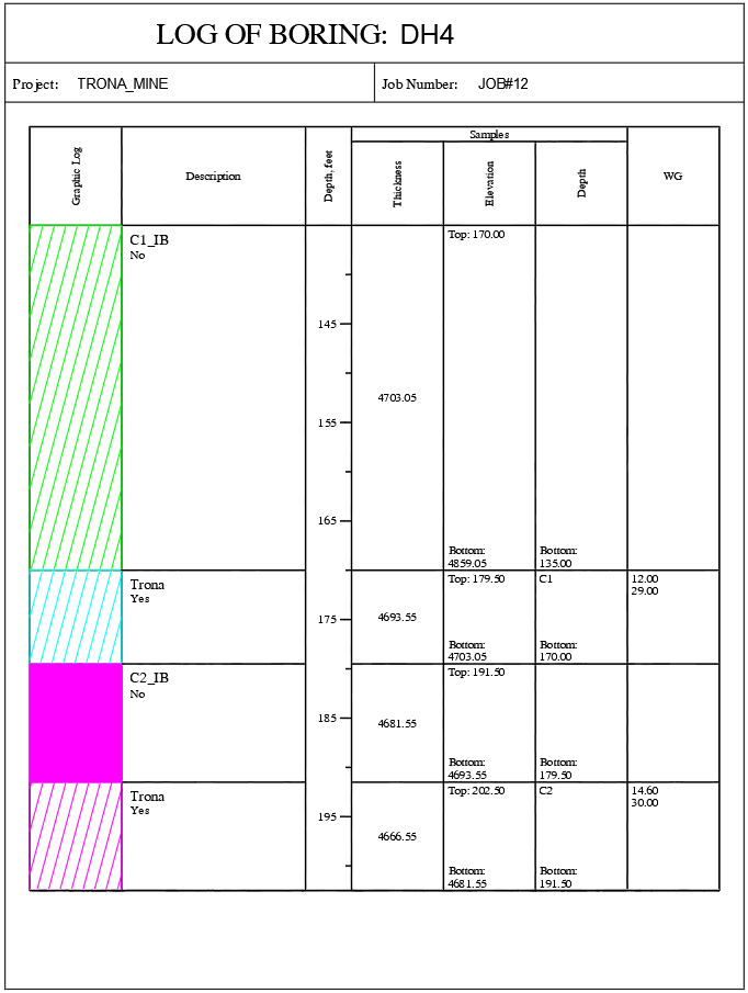
With the same Carlson module, we are also able to generate borehole log reports—giving more detailed information for individual drillholes as shown in the image for DH4 .
Some specific tasks that can be accomplished with the Carlson geology module with respect to drillholes and modeling are listed below.
Drillhole Utilities
- Import from any format using custom settings.
- Store drill data directly in the CAD drawing or dynamically link to external databases.
- Draw geologic columns in section-view or in 3D to correlate strata.
- Validate holes with queries and reports.
- Use tools such as Strata Polylines, Horizon Codes, and Drillhole Equations to build complex models.
- Import E-Log geophysical LAS files and core images.
Geologic Modeling Utilities
- Use industry-standard modeling algorithms and supporting commands to ensure accurate representation of the geology.
- Create macros to update models with new data.
- Investigate models with inspection tools and colored, hatched isopachs.
- Enhance models with Limit Lines and Strata Polylines for detailed strata behavior.
- Automatically model strata pinchout and seam splits.
- Account for incomplete drilling with conformance settings.
- Compare geologic models and user-modified mining models to quantify available vs. recoverable reserves.
Block Modeling
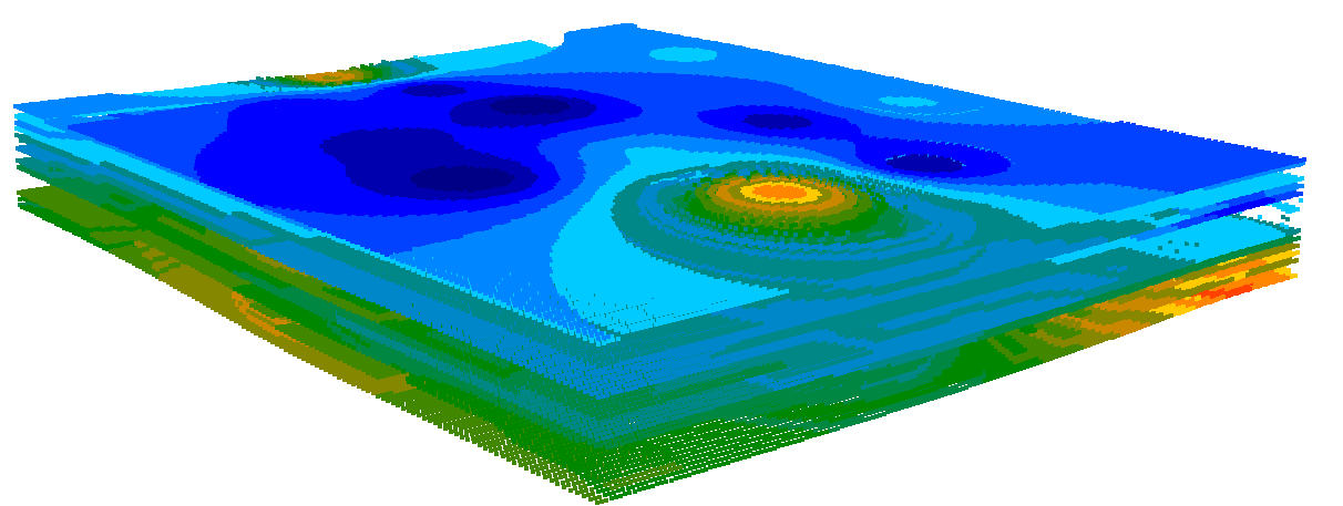
One downstream use of all the drillhole data collection and strata modeling, especially in mining, is the generation of a block model. The block model is made up of symmetrically shaped same-sized blocks(cubes for example) in the target strata. The characteristics of each block will differ with respect to the next block. Characteristics such as grade, quality, density will be unique to each block within the block model. Once developed, the block model can be interrogated and analyzed to determine the ore resources and reserves. Building the block model takes into account the economics of the mineralized orebody and informs the economic viability of a project. A block model for a limestone quarry for example, may look as in the image below.